15 U S BATES ROAD
Owner Information
GOLDSTEIN JAYSON I & CHRISTINA D
15 U S BATES ROAD
HINGHAM, MA 02043


Property Details
15 U S BATES ROAD is classified as a Single Family Residential (Cape cod).
The primary structure on this property was built in 1930. There are 3,704ft2 of built area within this property. There is 1,588ft2 of residential/living space within this property. This property is listed as having 6 rooms.
15 U S BATES ROAD is valued at $666,300. The land is valued at $395,400 and the structures are valued at $270,900.
This property is in Zone RB. Confirm with local Zoning Board authorities to ensure there are no overlays or other easements on this property.
The most recent deed for 15 U S BATES ROAD is recorded at the local registrar in Book 647, Page 60. 15 U S BATES ROAD was last sold on Thursday, November 14, 2019 for $714,000.
Assessment data from fiscal year 2022.
Flood Data
According to the FEMA National Flood Hazard Layer, this property does not appear to be in a flood zone. It may also be in an area not yet reviewed. Nonetheless, confirm this information prior to taking any action.
To view the flood hazards around this property, create a FEMA "Firmette" Map of the area around 15 U S BATES ROAD.
Broadband Internet Providers
| Provider | Type | Bandwidth (mbps) | |
|---|---|---|---|
| Viasat Inc | Satellite | 100 | 3 |
| Verizon New England Inc. | DSL | 5 | 0 |
| Comcast | Cable | 1000 | 35 |
| GCI Communication Corp. | Satellite | 0 | 0 |
| HughesNet | Satellite | 25 | 3 |
| Verizon New England Inc. | Fiber | 940 | 880 |
| VSAT Systems, LLC. | Satellite | 2 | 1 |
Broadband service provider data from December 2020.
Adjacent Properties
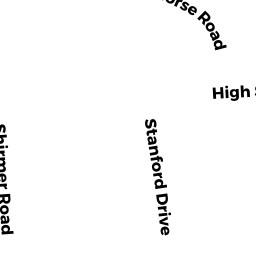
- 116 HIGH STREET
Single Family Residential owned by MALONEY STEPHEN & MARIE A - 120 HIGH STREET
Single Family Residential owned by BERRY RICHARD K & KATHLEEN A - 128 HIGH STREET
Single Family Residential owned by LAIVO JANET P & WAITE PHILIP A - 136 HIGH STREET
Single Family Residential owned by CLANCY RICHARD & MACDONALD JOANNA - 11 U S BATES ROAD
Single Family Residential owned by ROBINSON CHRISTOPHER R & PAMELA - 16 A U S BATES ROAD
Undevelopable Residential Land owned by WARD FRANCIS V III & KATHLEEN M WARD - 146 HIGH STREET
Single Family Residential owned by CELIDONIO ERIC F & MARGARET E